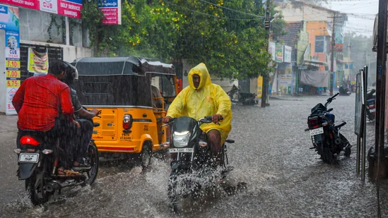
As Cyclone Senyar gathers force over the Bay of Bengal, India braces for an afternoon landfall that could reshape the weather across the southern coast.

A Sudden Intensification Over the Bay of Bengal
Cyclone ‘Senyar’, which began as a low-pressure system over the Strait of Malacca earlier this week, rapidly intensified into a cyclonic storm according to the India Meteorological Department (IMD). As of 26 November 2025, authorities confirm that the storm is set to make landfall this afternoon along the Tamil Nadu coast, bringing heavy rainfall, rising sea levels, and dangerous wind speeds.
Meteorologists have noted that the rapid intensification of Senyar is a matter of concern, as storms in the Bay of Bengal are known to escalate quickly, leaving limited time for precautionary measures. The IMD has issued multiple alerts warning that sea conditions are expected to be extremely rough, urging fishermen and coastal communities to stay away from the shoreline. Schools and colleges in several districts have announced closures as a precaution.
Regions Likely to Be Hit: Cyclone Senyar
The storm’s trajectory indicates a high-impact stretch from Tamil Nadu to coastal Andhra Pradesh, with surrounding states also preparing for severe weather. Heavy to very heavy rainfall is predicted in:
- Tamil Nadu (especially coastal and delta regions, including Chennai, Cuddalore, Nagapattinam, and Thanjavur)
- Kerala (particularly coastal districts like Kozhikode and Alappuzha)
- Coastal Andhra Pradesh (including districts such as Visakhapatnam and Srikakulam)
- Andaman and Nicobar Islands
- Lakshadweep
Residents in these regions may experience thunderstorms, flooding, power disruptions, uprooted trees, and waterlogging as the system continues to push inland. Meteorologists also warn of the possibility of localized landslides in hilly areas due to prolonged heavy rainfall.
What the IMD Has Said: Cyclone Senyar
According to the IMD, Cyclone Senyar is expected to bring:
- Wind speeds between 70–90 km/h, with higher gusts near the storm’s eye, capable of causing structural damage
- Very rough sea conditions and storm surges in low-lying coastal areas, affecting ports and harbors
- Heavy rainfall bands spreading across southern India throughout the day, which may lead to urban flooding in major cities like Chennai and Kochi
The agency has urged residents in vulnerable zones to stay indoors, avoid unnecessary travel, and follow advisories issued by local disaster management authorities. Emergency services have been instructed to be on high alert to respond quickly to any situation.
Impact on Daily Life: Alerts and Precautions
With landfall expected in a matter of hours, authorities have already activated emergency protocols across coastal districts. Precautionary measures include:
- Suspension of fishing activities and closing of small harbors
- School and college closures to prevent travel during heavy rain
- Evacuation support for low-lying areas and coastal villages
- Deployment of National Disaster Response Force (NDRF) teams in high-risk zones
- Travel advisories for air and road transport to prevent accidents and traffic disruption
Local governments are coordinating with state authorities to ensure that emergency shelters are stocked with essentials and that hospitals remain ready for any medical emergencies. Citizens are advised to keep emergency kits, drinking water, non-perishable food, flashlights, and medicines ready.
Why Cyclone Senyar Matters: Cyclone Senyar
Weather scientists note that rapid intensification of storms in the Bay of Bengal is becoming more frequent due to warming ocean temperatures and changing climate patterns. Cyclone Senyar’s sudden rise from a depression to a cyclonic storm within a short span reflects this emerging trend. Its impact could influence agricultural activities, marine ecosystems, and water distribution in the southern region. Early action and preparedness can significantly reduce potential damage and loss of life.
Conclusion: Cyclone Senyar
As Cyclone ‘Senyar’ inches toward the Indian coastline, the next few hours are crucial. With IMD forecasting an afternoon landfall, southern India must remain on high alert. While authorities are prepared with response teams and evacuations, individual caution and timely action will determine how safely communities navigate this unfolding weather event. Continuous updates from the IMD, local authorities, and news channels will be essential for residents to stay informed and make timely decisions.
FOR MORE BLOGS – beyondthepunchlines.com

 Add to favorites


